Some 80% of organisational data contains a location component.
Yet many intelligence gathering systems don’t have a geographic element, the absence of which frequently leads to serious analytical blind spots. We are here to help you in pinpointing that vital information, connections and patterns you need to make better, more insightful decisions.
We build web-based decision support solutions to assist your decision making in a number of business areas. This includes:
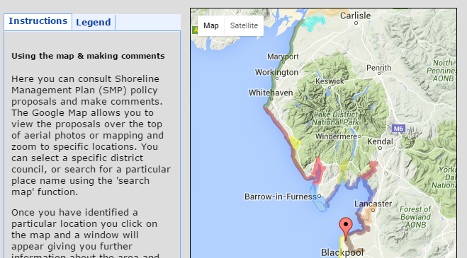
Multi-layered location analytics, delivered via our cloud-based geographic information technology (GIS), providing you with the simplest, most cost-effective way of avoiding data gaps.
Configured to meet your precise needs and provide you with any information you want – no paying for unnecessary packages.
Front-loading the engagement of a range of stakeholders to make your decision making run smoothly.
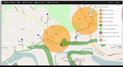
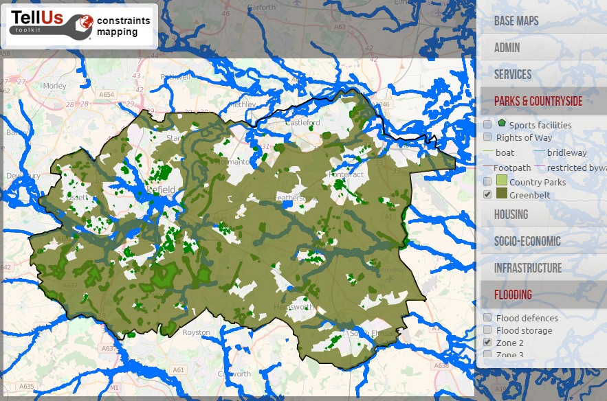
Through deeper, more connected insights, visually represented on maps, we translate even the most complex messages into easy-to-interpret information, revealing patterns than can easily be missed in endless tables of stats.
We are a young company growing fast based on 20 years of location analytics research.
We provides a tailored package of map-based software tools to support business decisions and stakeholder engagement.

We are a dynamic team with a range of experiences in the built environment sector. We have backgrounds in urban planning and development, stakeholder engagement and spatial decision support systems using geographical information science or GIS.
We work with a wide range of clients in the utility, environmental and public policy sectors offering a range of services.
We also have expertise to engage with a range of external stakeholders.
The idea behind what we do has always been about harnessing the power of maps and Geographical Information Systems (GIS) to engage a wide range of stakeholders in decision making about places.
TellUs Toolkit Ltd was set up in 2015 by Richard Kingston and UMIP (University of Manchester Intellectual Property) to capitalise on the knowledge generated by over 20 years of research in to using web-based mapping tools to support spatial decision making.
Tellus is a latin word meaning 'earth' and has roman and greek origins with Tellus being the ancient roman goddess of earth which in greek mythology translates to Gaea, or mother earth.
So, with our expertise in both GIS (maps of the earth) and stakeholder engagement 'tell us' seemed like a logical name for what we do!
You can get in touch with us in a number of ways...
TellUs Toolkit Ltd.
Manchester
info@tellus-toolkit.com
+44 (0) 7880 744 802